Ross Creek Stormwater Improvement Project
Watershed: Swannanoa
Location: Chunns Cove & Kenilworth Communities
Ross Creek begins its journey down the mountain within the steep slopes of Chunns Cove paralleling Chunns Cove Road as it travels down along Tunnel Road, turning into Kenilworth, forming Kenilworth Lake, then descending south to the Swannanoa River. Ross Creek watershed consists of all the land draining water to Ross Creek and Kenilworth Lake. The watershed covers a three-square-mile area including Chunns Cove, a large part of the Kenilworth community, and the commercial area along Tunnel Road from Beaucatcher Tunnel south to the Days Inn. It also includes the eastern slopes of Patton, Sunset, and Beaucatcher mountains as well as the western slopes of Randall Gap, Cisco Mountain, and Piney Mountain. This map depicts the Ross Creek watershed including the watershed boundary, streams, major roads, and communities.
A watershed is the area of land where all of the water that is under it or drains off of it goes into the same place. John Wesley Powell, scientist geographer, put it best when he said that a watershed is:
“that area of land, a bounded hydrologic system, within which all living things are inextricably linked by their common water course and where, as humans settled, simple logic demanded that they become part of a community.”
Watersheds come in all shapes and sizes. They cross county, state, and national boundaries. In the continental US, there are 2,110 watersheds; including Hawaii, Alaska, and Puerto Rico, there are 2,267 watersheds. Craven St Watershed is a sub-watershed within the French Broad River Watershed.
Project Description:
The Ross Creek Stormwater Improvement Project is an effort to implement portions of the 2007 Ross Creek Master Plan. Numerous stormwater best management practices (BMPs) where identified in the plan, yet due to funding restrictions, land availability, and willing partners, only two opportunities are feasible at this time. Through funding from North Carolina’s Clean Water Management Trust Fund and in-kind support from The City of Asheville and RiverLink, this project implements two (2) of the projects identified in the Master Plan, one at St. Luke’s Church on Chunns Cove Road and the other on residential property at the corner of Waverly and Lakewood Dr.
Project Goals:
- Provide treatment of stormwater originating from roofs, parking lots and roadways
- Installation of a vegetated wet swale and stream bank enhancement at St. Luke’s Church, to provide treatment of runoff, reduce erosion, and reduce flooding
- Installation of Wetland and stream improvements at Lakewood Dr. and Waverly Dr. in Kenilworth, to provide treatment of runoff, reduce erosion, and reduce flooding
- Provide expanded educational opportunities for the community
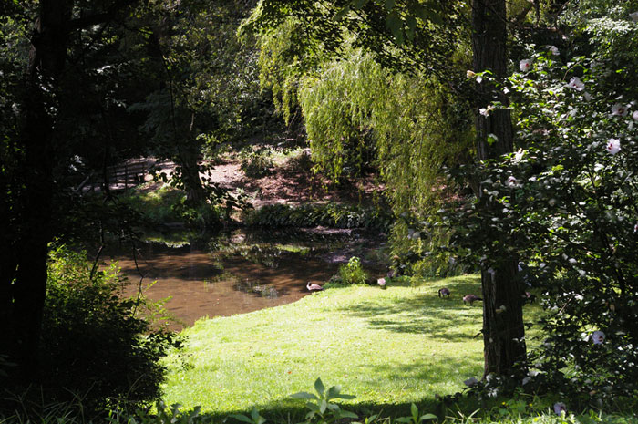
Lakewood Drive:
This property is owned by Dr. John Umhau, given to his son-in-law by Asheville and Kenilworth resident, David Herbert. The property is steep and narrow, as it is cut through the center by a tributary to Kenilworth Lake. The proposed project develops a stormwater wetland at the eastern end, trapping and reducing pollutants and sediment from entering the lake. Additionally the project proposes stabilizing small sections of stream to protect the long term structure of the drainage and proposed wetland. RiverLink will be assisting the project through hosting volunteer invasive species removal workdays in the spring of 2013.
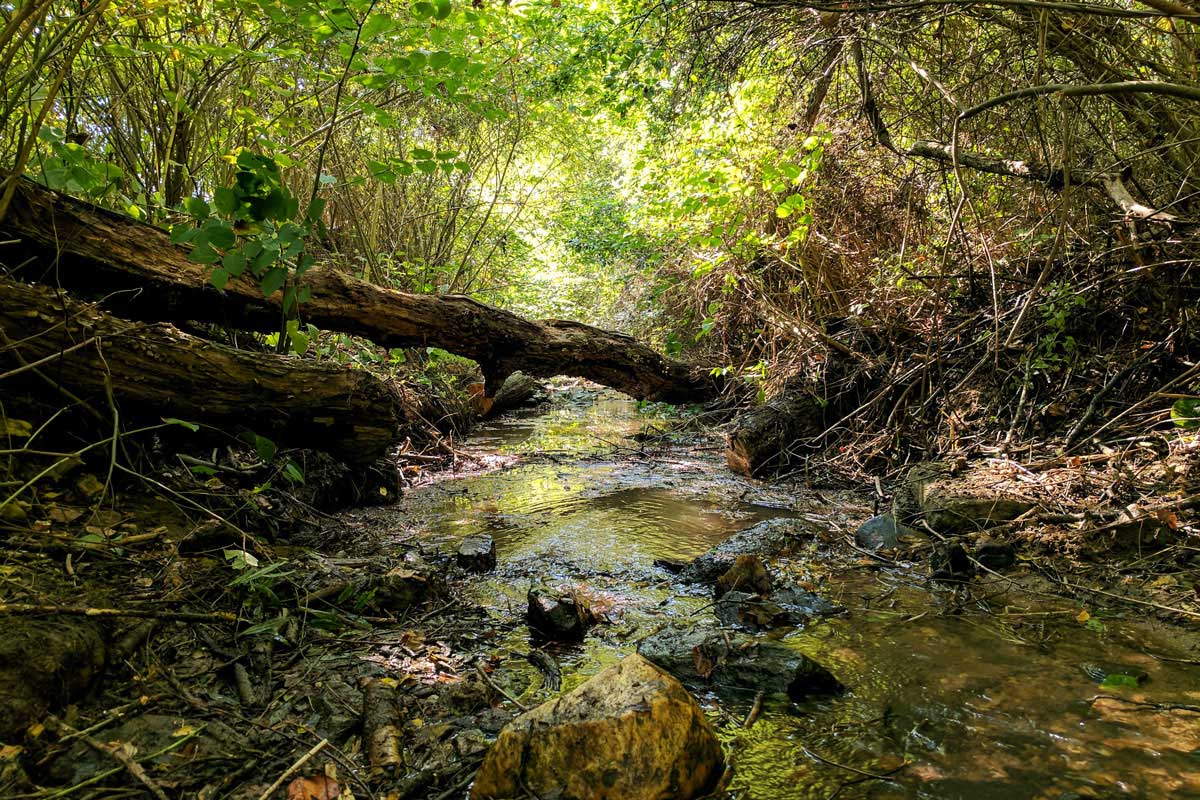
St. Luke’s Church:
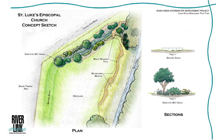
Ross Creek borders the church’s property along the eastern boundary. Between the creek and the church there is a large grassed field, the gravel parking lot wraps the north end of the field between the church and Chunns Cove Rd. This project proposes a grassed swale, which parallels the main parking area, turning to a vegetated wet swale as it winds around the front of the field. This will clean water draining from Chunns Cove Rd and the church before it enters into Ross Creek. The all native planting will improve water quality and enhance St. Luke’s Fellowship Actions Impacting the Habitat (FAITH) designation by the NC Wildlife Federation, as a place of worship that has enhanced the habitat and displayed good stewardship of native flora and fauna for all to enjoy.
Over the past 5 years the church established a butterfly garden, eliminated its pesticide use, and has been removing invasive species from the riparian area as part of the FAITH program. Over the past six months RiverLink volunteers and staff, along with church and community members, have teamed up on efforts to remove the invasive species. These efforts will continue throughout the project and include minor stream bank grading and the replanting of these areas with native riparian plants.
History of Chunns Cove:
Ross Creek begins its journey down the mountain within the steep slopes of Chunns Cove paralleling Chunns Cove Road as it travels down along Tunnel Road, turning into Kenilworth, forming Kenilworth Lake, then descending south to the Swannanoa River. Chunns Cove was once home to Chunns Cove camp for girls , one of the first camp for girls in the area. Around the same time, architect Douglas Ellington built his residence about a mile up from the camp. Before the city brought water to Chunns Cove, natural springs, which fed Ross Creek, were used for water at the Ellington residence. As Asheville grew, so did Chunns Cove; the area is now home to over 400 residences.
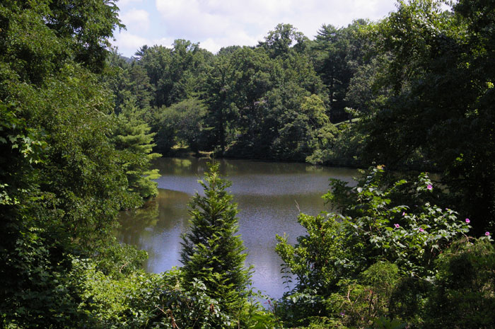
History of Kenilworth Lake:
Kenilworth Lake was created by James “Jake“ Chiles, the land developer who created the Kenilworth neighborhood. In 1916, shortly after the Kenilworth Inn was demolished by a fire, Chiles reconstructed the Inn as a luxurious resort. It opened in 1926, when the work began on the residential side of Kenilworth. The Kenilworth neighborhood developed quickly, due to the location and recreational opportunities. Chiles purchased the hunt club in Happy Valley to expand to neighborhood. Most areas where planned as residential, yet a large area was set aside to be developed as a golf course or lake. Around this time Chiles visited Castle Kenilworth in England, after which the neighborhood was named. Chiles discovered the castle property contained a lake, and brought this concept to Asheville, developing Lake Kenilworth in 1925 at a cost of $108,000. Since, the lake has been enjoyed by residents, providing recreational opportunities, wildlife habitat, and scenic views. Today the lake is maintained by the Kenilworth Lake Association, which originally formed to raise funds to repair the dam, proving how invaluable the lake is to its community.
In 1999, the North Carolina Division of Water Quality (DWQ), sampled the stream’ benthic community. The field staff inventoried the bottom-dwelling creatures in the stream, such as snails, mussels, and aquatic insects. Some of these organisms are highly tolerant of pollution while others are sensitive. This enables us to predict water quality by looking at the number and type of these organisms in the stream. Samples were taken upstream at St. Luke’s Church in Chunns Cove, and downstream at the AMF Bowling alley. Based on these samples the upstream site was rated at the lower end of “good-fair” and the downstream was rated as “poor”. Due to this rating, in 2000 DWQ designated Ross Creek from I-240 to the backwater of Lake Kenilworth as impaired due to habitat degradation, sighting urban runoff as the potential source. Ross Creek has since remained on the list. DWQ monitored Ross Creek again in 2002, with no conclusive improvement, and the Volunteer Water Information Network (VWIN) at EQI continues to monitor today. These efforts assist us in identifying the problems and sources of degradation used to develop a watershed plan with specific recommendations for restoring the health of Ross Creek and Kenilworth Lake.