In a continuing series honoring RiverLink’s 40th year, we bring you a deep dive into the history of Carrier Park, Asheville’s most visited public riverpark.
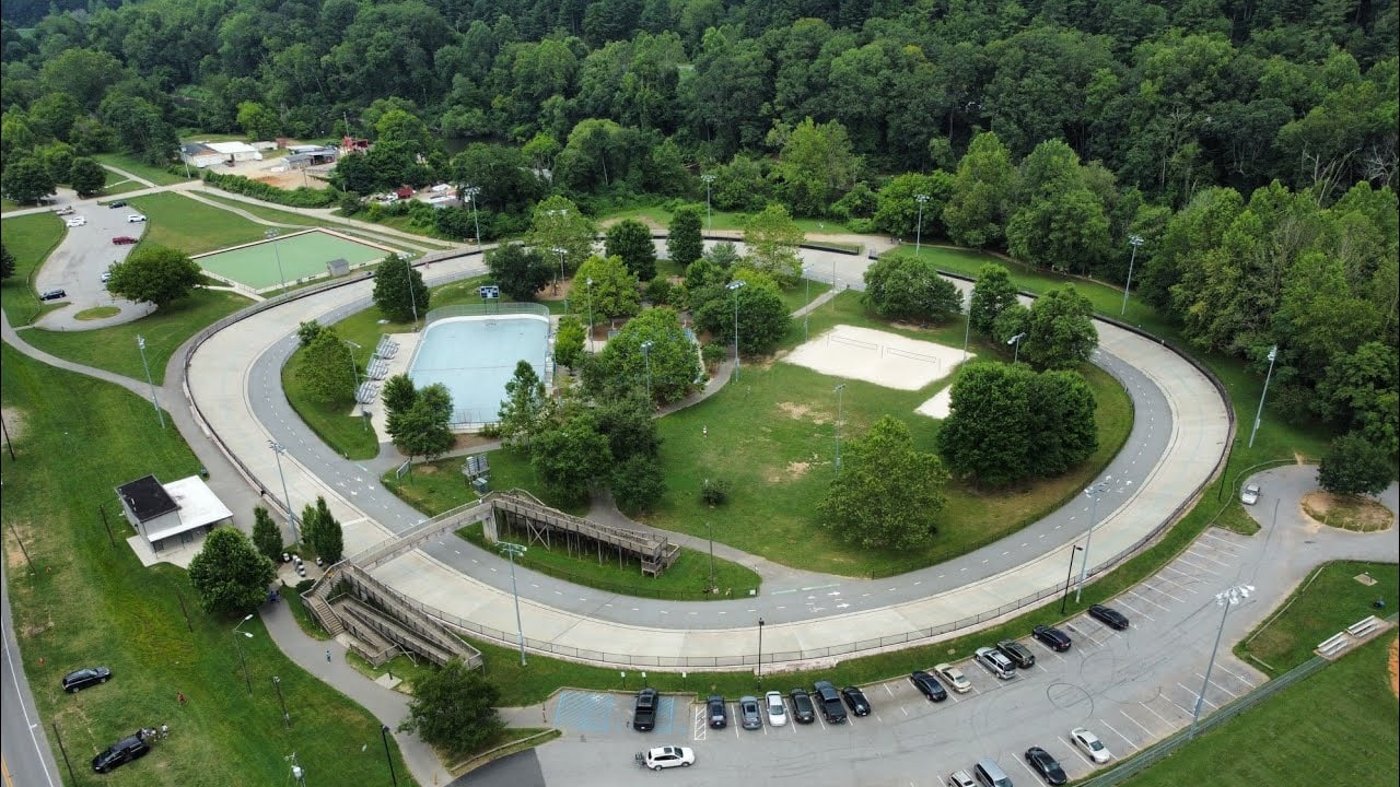
When residents view Carrier Park today, many see a basketball court, playground and an asphalt track from the 1960s, repurposed for bikes and roller bladers, much of it in disarray owing to Helene’s catastrophic flooding nearly two years ago. However, scholars and historians have worked closely with organizations including the Eastern Band of Cherokee Indians to conceptually peel back the years and those layers of asphalt.
Going To Water
For the native Cherokee people, flowing rivers and streams are considered sacred and alive, and the French Broad is personified as a “Long Man” whose head rests in the mountains and whose feet trail into the sea. “Going to Water” is a foundation of Cherokee spirituality, a purification ritual performed each morning at daybreak, regardless of the season, to wash away illnesses, physical impurities, negative thoughts and spiritual pollution. It is virtually certain the ceremony would have been practiced along the river where the greenway lies now, as Hernando de Soto’s 1540 expedition recorded a Cherokee town called Guaxule. Because the river was holy, strict taboos existed against releasing human waste or letting animals contaminate the water. In Cherokee tradition, the confluence of two rivers concentrates spiritual energy and power, and the confluence of the French Broad and Swannanoa Rivers just downstream from today’s Carrier Park was important for ceremony and also as a place “Where They Race” in traditional canoes – conferring the Cherokee name for this specific river bend, Tokiyasdi, ᏙᎩᏯᏍᏗ.
19th Century Origins — The Carrier Name
The arrival of Europeans brought major changes to the area, including the railroad and many 19th Century structures repurposed for ongoing use today. The park’s namesake is Edwin Carrier, a West Asheville developer who built a low wooden dam and power plant on Hominy Creek in 1889 — the first hydroelectric plant in Western North Carolina, providing Asheville’s earliest reliable electric lights. That same year he built Carrier’s Bridge, a 250-foot steel bridge spanning the French Broad at its junction with the Swannanoa, and construction soon began on the West Asheville and Sulphur Springs Electric Railway. This railway ran from the passenger station on Depot Street, across Carrier’s Bridge and along what is now Amboy Road to Sulphur Springs – a watery attraction thought to cure a long list of maladies – and to The Belmont, Asheville’s first health resort hotel, also built by Carrier. In 1892, he created a horse race track close to where Carrier Park sits today.
1960s–1990s — The Racetrack Era
The modern track many residents remember was created in 1960 as a dirt oval known as the New Asheville Motor Speedway (nicknamed “The River” for its spot along the French Broad). In 1961 the track was paved, and Asheville experienced an exciting era of short-track racing. Rivalries between local racers were intense, and fans came as much for the fights during and after the Friday night races as for the racing itself. Track owner Bob Greenwood reportedly offered drivers under-the-table payments or free tires to wreck rivals, and announcer Shug Thompson added color with lines like “Here they come, all lined up like grandma’s onions.”
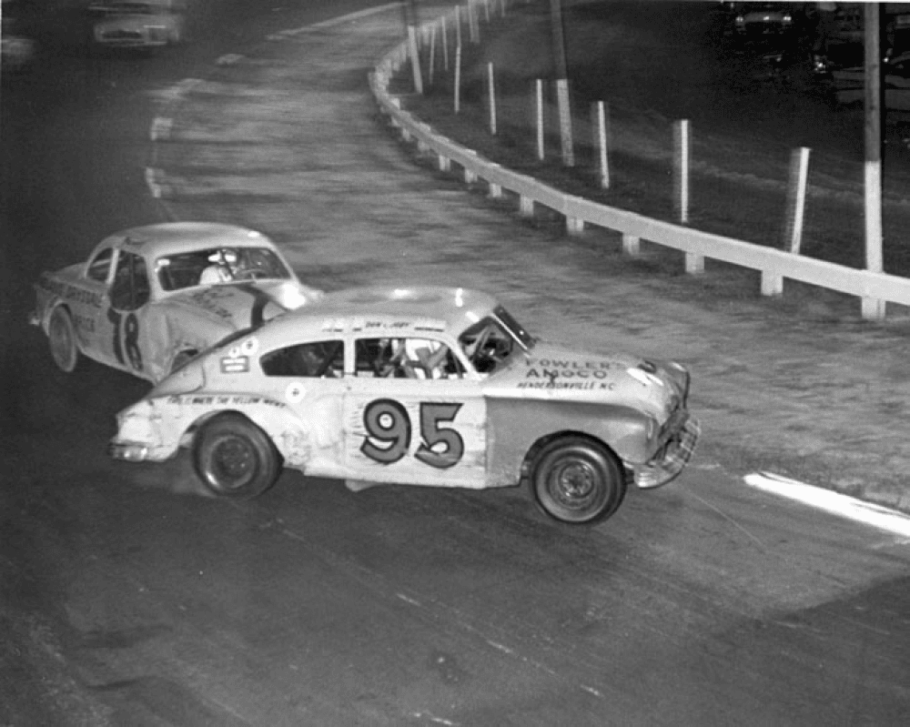
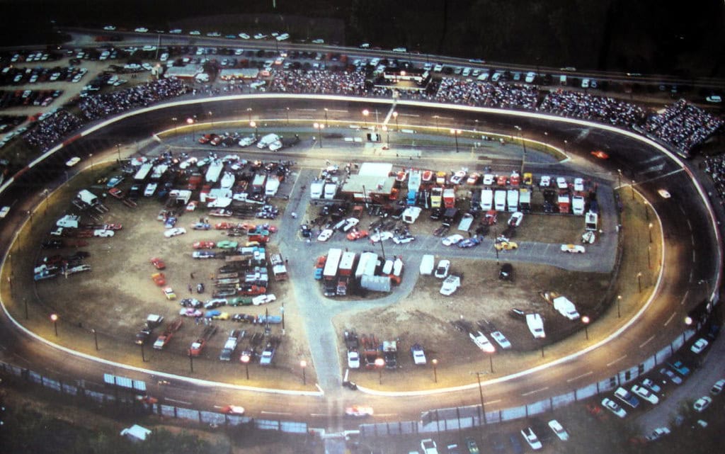
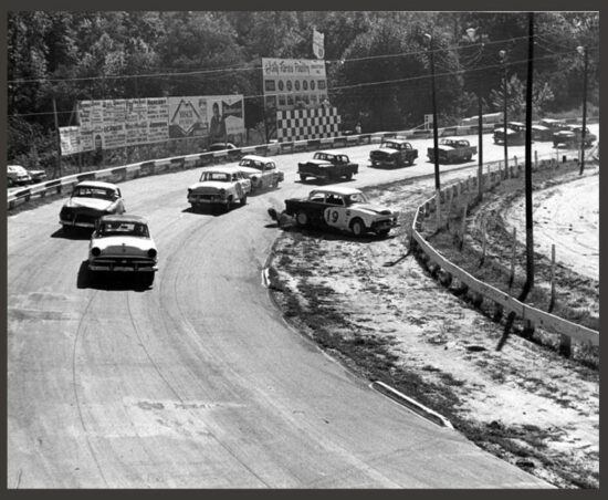
The speedway hit the big leagues too: it hosted eight NASCAR Grand National circuit races between 1962 and 1971, with winners including Junior Johnson and Richard Petty. Racing continued until the final checkered flag waved on September 17, 1999.
Tracking the Transformation
The transformation actually started before racing ended. Creation of Carrier Park began in 1997, when then-speedway owner Roger Gregg decided to sell—to spend more time with his school-age son, he said, but also presumably to avoid future clashes with a strengthened city noise ordinance. That year, RiverLink secured grant funding from the NC Clean Water Management Trust Fund and some generous local donors to purchase the property, and the deed was immediately transferred to the City of Asheville for creation of a public park. Many racetrack lovers felt blindsided. A month after the transfer, a group called Speedway ’99 presented City Council with a petition of over 20,000 signatures asking for one final year of racing, and Council agreed. The land was leased to Carolina Motorsports in 1999 for $200,000 so fans could get a final season, with lease proceeds going toward designing and developing Carrier Park.
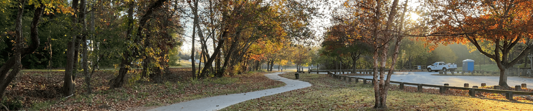
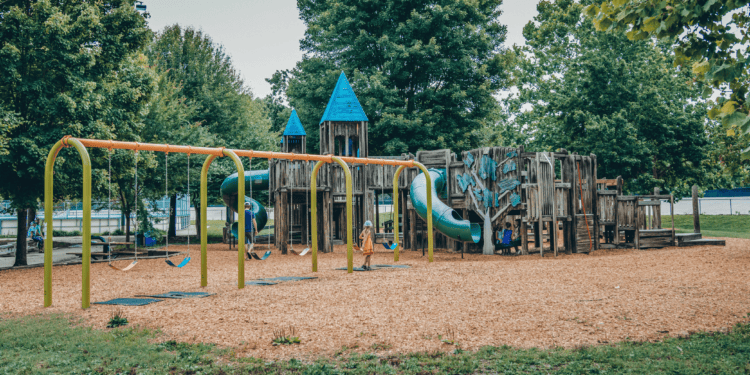
In 2001, RiverLink recruited volunteers to construct a community playground, providing momentum toward finishing the first phase which was dedicated in 2003 and included a volleyball court, roller hockey rink, playground, basketball court, lawn bowling, and trails. The old asphalt track itself was turned into a velodrome for biking and skating — now nicknamed the “Mellowdrome.” Phase two, dedicated in 2006, added a large picnic shelter, a river overlook, a wetland interpretive area, and more trails along the river.
Modern history
The original wooden playground was replaced with an updated version in June, 2024. Unfortunately, on September 27 of that year, Carrier Park was heavily damaged by Hurricane Helene’s catastrophic flooding, with parts of the park and the surrounding French Broad River Greenway sustaining major damage, especially where the paved path lies close to the river’s edge, and where woody vegetation has been removed to allow river views. The storm damaged or destroyed some 80 percent of buildings along Asheville’s riverfront; restoration has continued slowly since, with the city reopening sections of the park gradually.
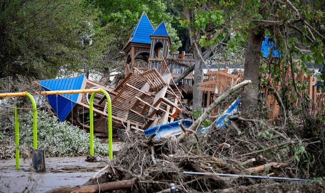
RiverLink has responded by re-energizing its original mission for restoration and revitalization of the river district. This has included months of stakeholder engagement to determine and find the funds to repurpose and rebuild with nature in mind, aligned with the needs of local property owners and creative entrepreneurs, coordinated by the international design firm, Sasaki. That effort has produced a Vision Statement that has excited the aspirations of riverfront community members seeking to rebuild for enhanced resilience in a known flood zone. Key elements of the plan are taking shape, including restoration of basic amenities like restrooms at the city’s riverparks; others await synergistic opportunity, such as a Creative Campus that will provide new spaces for working artists, exhibitions, live performance, and more. Helene provided critical lessons about what is safe to place in the flood zone – and what isn’t.
Today the City of Asheville is working towards restoration of their French Broad River parks and greenway spaces and are showcasing their most recent proposals. We invite YOU to make your wishes known for the public properties in the dynamic, deeply historic district along the French Broad – and as you do, consider advocating for the lessons learned. Surviving structures include the elevated and the historic (and permeable) brick buildings that have been properly repurposed; and our passive recreational green spaces are heavily used, and highly compatible with flooding. In short: When it comes to human development and the built environment, less is more in our mountain floodplains.